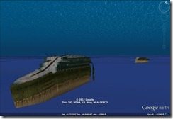
Using imagery from National Geographic, Google has come up with a tour and some very nice 3D images of the RMS Titanic on Google Earth.
The Titanic sank 100 years ago after striking an iceberg in the Northern Atlantic.
As technology progresses scientists and maritime explorers are able to glean more and more information from the mass of wreckage strewn across the sea bed.
Now, without getting your feet wet, just by typing into the Google Earth Search Box, you can explore the Titanic wreckage yourself.
Find out more at Google Lat-Long
Related articles
- Titanic – 3D (dougpete.wordpress.com)
- Remembering the Titanic (google-latlong.blogspot.com)
- RMS Titanic: 100 Years Later (tomdarby.me)


